Liege Maps and Orientation
(Liege, Wallonia, Belgium)
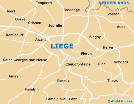
The city of Liege lies within the Walloon region (Wallonia) and the Ardennes area of Belgium. With some 200,000 residents, Liege is now a sizable Belgian city and is based close to the westerly bank of the Meuse River, close to the German and Dutch borders.
The Meuse River actually splits into two separate waterways and creates the natural Outremeuse Island, a busy district with a maze of small streets. Liege city centre is surprisingly large and navigating your way around this part of the city can be a little disorientating and confusing.
Maps and Orientation of the City
Situated on the southern side of the Place St. Lambert, the Gare Guillemins is the main railway station in Liege and is close to the bus station. The historic quarter of Liege is centred near the Féronstrée and it is on this street that you will find the tourist office (Office du Tourisme), which is a good source of maps.
The modern heart of Liege has evolved around the Rue Pont d'Avroy and it is here where many of the best eateries and shops reside. A number of small and winding pedestrianised streets are close by.
- Antwerp - 133 km / 83 miles (one hour and 40 minutes, north-west)
- Beringen - 71 km / 44 miles (one hour, north)
- Bilzen - 39 km / 24 miles (45 minutes, north)
- Brussels - 96 km / 60 miles (one hour and 20 minutes, west)
- Charleroi - 99 km / 62 miles (one hour and 25 minutes, south-west)
- Genk - 54 km / 34 miles (50 minutes, north)
- Hasselt - 53 km / 33 miles (50 minutes, north)
- Hayen - 20 km / 12 miles (25 minutes, south)
- Herstal - 6 km / 4 miles (14 minutes, north-east)
- Leuven - 75 km / 47 miles (one hour and five minutes, west)
- Moelingen - 21 km / 13 miles (25 minutes, north-east)
- Ottignies - 92 km / 57 miles (one hour and 15 minutes, west)
- Seraing - 9 km / 6 miles (15 minutes, south)
- Tongeren - 34 km / 21 miles (30 minutes, north)
- Weert - 130 km / 81 miles (one hour and 40 minutes, north)
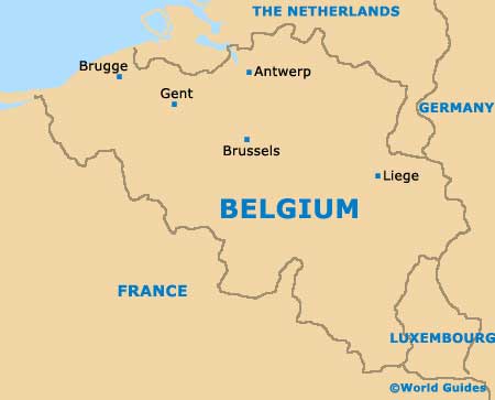
Map of Belgium
Map of Liege